

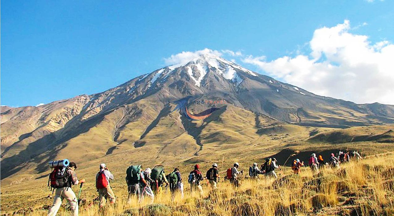
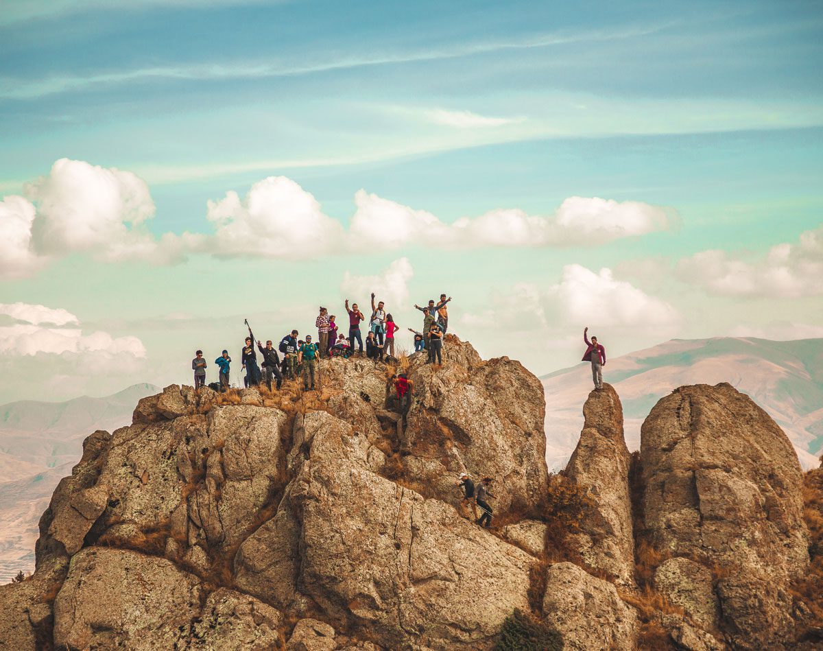
Iran and around Tehran have unique mountains and routes for climbing and hiking. Any person with any level of physical fitness can climb mountains in Iran. If you don’t have enough skills in this field, don’t worry. You can start with easier and less steep routes to reach enough skill.
There are many climbing routes in Iran that people can set a one-day to several-day plan for their climbing. With this, go to the heights and away from the bustle of the city and spend a few hours in peace. In Iran, many mountains show the beautiful and unique nature of the country. Mountains have been a symbol of strength and strength for people.
Some of these mountain areas are accessible, and it is possible to see and climb them. Iran has four mountain ranges. The Al-Bazar mountain range starts from the westernmost point of the shores of the Caspian Sea and extends to the north of North Khorasan. The longest mountain range in Iran, which covers the entire western to the southwestern region of Iran, is the Zagros mountain range.
Of course, you should note that besides the beauty of the mountains, there are also serious dangers, and to prevent these dangers, you must have the necessary climbing equipment with you. Also, if possible, do this with people who have climbed before.
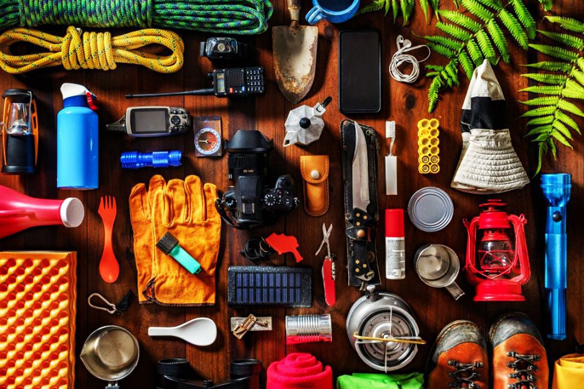
These accessories include the following titles. If you are a professional climber, you must know about them, but if it is the first time you want to go climbing, it is essential to know this list and prepare them.
- mounting backpack
- Suitable shoes and pants
- Sleeping bag
- Climbing tent
- First aid supplies
- Mountaineering helmet
- flashlight
- Socks and gloves
- Food and related dishes
Adventurers can reach a high level of excitement in nature, Whether it’s a nature adventure in the nearby forests or a week-long hike in the Andes. Trekking through nature is a great way to see other sides of the country, but to have an enjoyable adventure, hikers must take safety precautions and be careful not to embark on activities they have no experience in.
Maybe with the skills you know in yourself, even your thoughts will not get lost! Sometimes you go off the main path during your adventure in the middle of nature. In this case, you may get lost at any moment! So you should consider this situation in advance and have tools like a map and compass.
You may think these days that you don’t need these devices anymore with mobile phones and GPS, but also consider that if your mobile battery runs out, you can no longer use GPS. If you are lost in a safe environment, it is better to sit quietly for a few moments and try to relax as much as you can. Usually, those who get lost immediately freak out and cannot make a proper decision. If you are near the top, climb up to get a good view of the surrounding landscape.
Important points in climbing and hiking
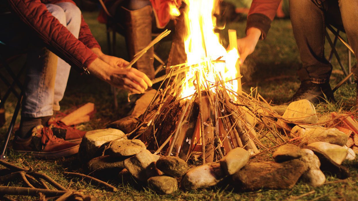
Have two ways to light a fire
Two means of lighting a fire are always recommended: matches and a lighter. Since you sometimes face many challenges in adventure and nature tourism, it is better to have two devices in case one is lost; you have another device to light the fire. If your adventure is mountain climbing and rock climbing, sometimes you have to stay in the mountains all night; in this case, you will see how useful the fire is during the night.
Know how to find clean water
One of the most critical points of climbing is the skill of finding water. Sometimes you find an urgent need for water, and your water bottles have run out; in this case, you should look for green areas or pay attention to the intersection of more complicated and softer rocks. You may think it is better to hit the ground to get to the water. It will take a lot of energy in a desert climate and may be useless. Do not use any water because sometimes clear water has dangerous bacteria and viruses that may make you sick.
Do not try all wild fruits and herbs.
It is true that you have gone to nature to touch the surrounding nature with an adventure, but you should know that your health is very important, and you can enjoy this adventure only if you take care of yourself. Sometimes along the way, you see many wild fruits and plants and are tempted to try their taste, but this is sometimes dangerous! Never try a fruit until you know precisely what it is.
Pay attention to your surroundings.
Pay close attention to your surroundings. It doesn’t seem like a crucial point, but sometimes you get so overwhelmed by reaching the peak that you may make a big mistake, such as taking a wrong step and making a mistake in navigation. It is better to pay attention to the road ahead and behind you while climbing to know what is happening around you.
The best climbing routes in Tehran
In contrast to Tehran, Iran also has many mountain climbing routes. The mountain north of Tehran is the southernmost mountain range of the Central Alborz, whose south side continues from east to west, from Farahzad valley to Darabad valley. There are many other valleys on this route, some north and some south.
If you do not intend to climb, you can visit these places and try the restaurants there.
Mountaineering in Tehran – Darband region
Darband is located in District 1 and the oldest neighborhood of Tehran, one of the mountaineers’ main destinations. If you intend to climb this place, you should know that there is a winding path in front of you, which starts from Darband Square.
To reach the top of the resort, you must pass through the village of Pas Qala, the Shirpala shelter, and the twin waterfalls. For this purpose, carry a thermos with you to drink water in case of thirst. In addition to climbing in Darband, you can also use the restaurants there.
Mountain climbing in Velanjak, from Darband to Derke
The hiking trail of Valenjak reaches Darband valley from the east and Derka valley from the west. Velanjak is located near Zafaranieh. Due to its special location, this area is considered one of the special areas for the residents of Tehran. This area is considered one of the most suitable places for mountain climbing due to its location between the Tochal mountains and the Derkeh and Darband valleys. The low and reasonable slope has made the Valenjak hiking trail popular for people who are not professional climbers.
It is possible to access Velanjak through Valiasr Street, Chamran Highway, and Yadgar Imam. This area is one of Tehran’s entertainment places with its cafe and restaurant and proximity to the Tochal cable car.
Even if you are not a mountaineer but want to spend time in the heights, you can see all of Tehran under your feet with the cable car and reach Kamachal, Qazgunchal, Sarbaz, Shahneshin, and Plangchal.
Velanjak has several hiking trails:
The first route: At the end of the residential area of Valanjak, there is a parking lot for the Tochal cable car. Tochal cable car parking, known as the origin of Valenjak hiking trails, is located 4 km from Tajrish square.
To reach the first station of the Tochal cable car, walk 2 kilometers.
This path does not have much slope and is one of the most suitable paths for walking. If you want to go higher with the cable car, you should know that this cable car at the seventh station will take you to a height of nearly 3,700 meters.
Second route: There is a dirt road from the first station of the cable car. This route is about 15 kilometers long and is zig zag. This zigzag has increased the length of the way. It is easier to follow this path.
The third route: From the first station of the cable car, there is also a hiking route. This hiking route is 12 kilometers long and will be more challenging to travel than the dirt road.
If you have taken the cable car to the seventh station, there will be several routes in front of you from there.
Mountaineering in Tehran – Darabad
One of the best mountain climbing routes in Tehran is Darabad, located northeast of Tehran. Darabad is a beautiful valley whose height reaches 1750 meters and continues to 2600 meters in the northwest and north directions. You can visit springs full of water, big and small waterfalls, and beautiful ponds.
At the entrance to the hiking trail in Darabad, you can see a kiosk known as Dostdaran Nature Lovers station, and after that, you can see the Paish Kohestan station on the right. A little ahead of these two, there is a signpost and a stone bridge.
For climbing on the Darabad route, there are three routes or roads ahead; the valley route continues for several hundred meters, after which you cannot continue. It becomes impassable. Although the valley’s path is short, you can enjoy the trail due to the water springs there. If you are a skilled climber and have enough skills, you can climb the steep slope on the right side of the waterfall and reach the main path through the rocks.
Darabad address
Tehran, Darabad, Darabad St., Mohebi St., Dar Abad Valley Hill
Darabad is one of Tehran’s mountain climbing routes; whether you are a beginner or a professional, you should know it and walk on this route once and for all.
The first route: The route through Dar Abad valley is considered a challenging route. This route is suitable for mountain climbers who have a lot of experience.
If you continue the valley, you can reach Darabad waterfall. Continuing the path to reach the peak of Darabad will be suitable only for very professional people in mountaineering. It is better to go back if you want to have fun.
Second path: There is an easy path for beginners and tourists on the left side of the valley. This path is equipped for family walks, and the toilet is also considered on this path. Human Park and Darabad Museum are located on this route. Therefore, this path is both fortune-telling and watching.
Third path: On the right side of the valley, there is a not-so-comfortable path. This route will end in Dar Abad Valley.
Tochal route
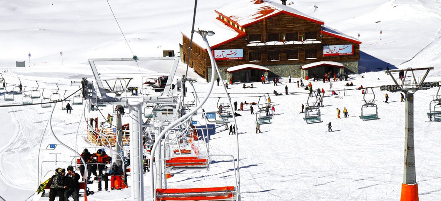
Valenjak climbing route is another one of the oldest climbing destinations in Tehran, whose peak has a height of 3960 meters and is located in the middle of the Alborz mountain range. This route is very popular among mountaineers, who suggest that you must be physically fit if you plan to climb this route. It is interesting to know that Tochal means water hole, which is known by this name because the peak of Tochal is located next to a lake of natural ice.
At first, this route starts from Velenjak and continues to the parking lot and station one. The suitable hiking route, which is spiral and has a low slope, continues to the second cable car station, which is about an hour away from each other. There are no convenience services from the second to the fifth station, so be sure to have enough water and food with you.
Note: Climbing this route in winter has risks, and there is a possibility of an avalanche, so check the weather conditions before going to this place.
Tochal facilities
There are different restaurants and cafes on the march route, a resort food court, Bam Tehran, various cable car stations, ski slopes, an entrance parking lot, and the first cable car station you can use.
Tochal address
Tehran, Shahid Chamran Highway, Yemen Street, end of Valenjak Street, Bam Tehran
Darkeh
Another route that is considered one of the most frequented hiking routes in Tehran is Darkeh or Plangchal. The height of this mountainous area is 2550 meters, and it passes through the beautiful Plangchal valley by the river. Darkeh Valley is safe and suitable for winter hiking up to the place called “Azghalchal.” The main hiking route to this point from Tehran is the Darkeh road towards Plangchal or Panj Tochal station, and many people use this route for climbing on their days off.
This six-kilometer route passes through the beautiful valley of Darkeh and Plangchal and by the Darkeh river. Of course, for hiking in the winter season, it is better to continue the route only to the area called Azghalchal because there may be dangers such as avalanches. Darkeh Tehran gets very crowded on holidays and weekends, so if you like to take advantage of the peace of this place, visit this neighborhood on other days.
The right path to Plangchal peak
In the northwest of Tehran, before reaching Tochal peak, which is one of Alborz’s peaks, there is Plangchal peak. This peak is 3,350 meters above sea level. There is a distance of 2000 meters from the origin to this peak. You can go to the seventh station of the Tochal cable car to climb this peak.
The existence of the cable car has made it possible for the enthusiasts who come only to visit the heights to reach the top of the resort by only walking about 5 kilometers. Mountaineers can also climb from Derkeh and even Bu Ali town. There are several routes to reach Plangchal Peak.
The first route: If you want to climb from Imamzadeh Dawood village, you have to cover a distance of 2,600 meters. This route is also called the western route. In summer, the western route can be more attractive than other routes.
The second route: You can also climb to Plangchal from Derka Valley. You should be aware that this path will not be easy for beginners and people who are not athletes. Passing through the Derka valley, you will reach the Plangchal shelter, and then the Plangchal peak is waiting for you. The height you will get by taking this route is about 1800 meters.
The third route: from the peak of Chin Kalag to Plangchal, you have to walk about 1900 meters high.
Farahzad route
Another route, considered one of the most dangerous for climbing, is the Farahzad route, which is located at an altitude of 1,650 meters and by crossing a 15-kilometer winding dirt road at the endpoint of the Holy Shrine of Amzadeh Dawood at an altitude of 2,600 meters. Ends This route is one of the oldest and most famous hiking routes north of Tehran, and until 30-40 years ago. Walking on this beautiful road along the Farahzad Valley takes about five hours. Some tourists travel this road with extended chassis and two-wheel drive vehicles.
The most important climbing routes in Iran
Sabalan mountain
Sabalan is the third highest peak in Iran after Damavand and Alamkoh and is considered one of the 1,515 most prominent peaks in the world. The height of its peak is 4,811 meters, and there is a small lake on top of the peak. Sabalan Mountain is located 35 km west of Ardabil city and 25 km southeast of Meshginshahr city.
Sabalan is popular with tourists because of the natural spas on the mountainside, especially Sarein and Shirvan Dareh, the beautiful summer nature, and the Alvares ski resort.
After seeing the sights of Ardabil, visitors can visit the hot springs of Qotur Sui. Then go to Meshginshahr, which is famous for its buttermilk soup, then don’t miss the Shabil hot spring, one of the must-see places in Meshginshahr, which is surrounded by huge orange lilies. Continuing the route and climbing to Sabalan peak is suitable for experienced and professional climbers with special equipment.
In addition, the best time to climb the peak is from mid-June to early September. Sabalan mountain generally has three famous peaks, its prominent peak is known as Sultan, and the other two peaks are known as Herm and Kasra.
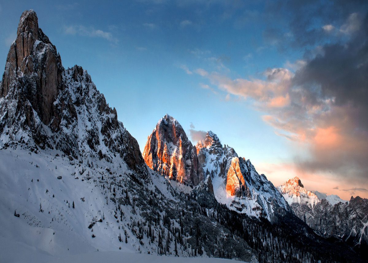
Alam mountain
Takht Suleiman mountain in the Alborz mountain range has 160 peaks with a height of more than 4,000 meters, the highest of which is Alamkoh, which is 4,850 meters. The fame of this peak is primarily due to its northern slope wall, which has the most technical and complex rock climbing routes in Iran and competes with the world’s most famous 90-degree rock and ice climbing wall.
Although there are four routes to access this peak, Rodbark in Kalardasht towards the north is the most famous access route. Those interested should drive 1.5 hours to Vandarbon and Khorramdasht, where the villagers are engaged in raising sheep. From this area, they have to climb for about 1.5 hours to Hesar Chal, which is full of yellow and green flowers and is surrounded by peaks and glacial lakes. It is a popular camping area in the summer, and its wildlife includes mountain goats and rams.
Zard mountain
Zardkoh or Zardkoh Bakhtiari is a mountain in north-central Zagros, which is located in the southwest of Iran. This mountain is located near Kohrang city, Bakhtiari region between Chaharmahal, Bakhtiari, and Khuzestan. With a height of 4,221 meters, Zardkoh is the second-highest mountain in the Zagros mountain range, after Dana Mountain, and one of the 1,515 most prominent peaks in the world.
Zardkoh is called this because of its yellow soil. We suggest you start your trip from Shahrekord, the province’s capital, and then go to Farsan and Chalgerd, where Bakhtiari nomads do their summer migration. Continue to Kohrang Lake. Although spring is the best time to visit Zardkoh, it is possible to ski on some of its slopes in winter.
Sahand Mountain
Sahand is the name of a volcanic peak and mountain range in the south of Tabriz, with 17 peaks with a height of more than 3000 meters. Sahand is one of Iran’s most important dormant volcanic mountains and is known as the bride of Iran’s mountains due to its abundance of plants, lawns, flower beds, and pastures. Unlike other mountains in Iran, which are rocky, Sahand Mountain is mainly soil and is considered an excellent environment for grazing.
Sahand Mountain is mainly soil and is considered an excellent environment for grazing.
Unsurprisingly, the best sheep and cheese belong to Liqvan near Tabriz. The highest peak of Sahand is Kamal, with a height of 3,707 meters, which can climb from the two routes of Maragheh and Tabriz, and at the same time, it witnessed the life of the nomads of this region. As long as you are in this area, you can do two things with one arrow and go to Sultan Daghi Peak.
First, visit the rocky village of Kandwan, which has cone-shaped houses carved into the heart of the rocky mountains, and then proceed to the summit. You will see wild purple flowers on the mountainside. If you climb to the top, you will be faced with a beautiful view and see that this climb was worth it.
Biston Mountain, Kermanshah
The height of this mountain is 2760 meters, and it is one of the mountains of the Zagros mountain range. This mountain, also known as Behsitun or Biston, is located on the slopes of Zagros mountain in Kermanshah province, west of Iran. This peak is one of the world’s most challenging rock climbing routes with its 2760 meters wide, five kilometers-wide wall and vertical rock with three large arches with a height of 1200 meters.
Biston mountain is not only a climbing place but also a world heritage and a historical attraction. Inscriptions and carved monuments were built by Dariush, the largest, most famous, and among the first known inscriptions in Iran. Biston mountain is very reliable in terms of its shape, design, and location, and it is mentioned in many works and poems of Persian epic literature.
Climbing in the mountains of Kurdistan
Kurdistan province is a unique region in the Zagros mountain range. Its amazing scenery, rich culture, and Kurdish language distinguish this region from Iran because of its fantastic scenery. Tourists traveling to Kurdistan can enjoy the pristine nature and, at the same time, learn more about the Kurdish culture.
One of its most famous mountains is Shahu Mountain, which extends from the east of Sulaymaniyah to the north of Ravansar. The Shahu mountain range is a part of the Zagros mountain range, which is located on the border of Kurdistan and Kermanshah provinces and near the Sirvan river. Zarivar Lake in Marivan is also considered a great and famous place for hiking, although it does not reach the stunning beauty of Oraman Takht.
Conclusion
There are many hiking trails in Iran, and you can go to these areas for hiking. But for this, you need sufficient preparation, the necessary equipment, and know the route. Also, if you plan to climb in winter, make sure to do so with enough equipment and skills. Often, professional and experienced climbers have had accidents on the trails.
In addition to passion, climbing requires a lot of caution because any carelessness may cost you or your companions. Also, learn the necessary skills along with your activity, such as map reading and working with a compass and GPS that will guide you on the way. If you need help, don’t forget to call 125 without delay.


Join The Discussion