
Suppose you plan to stay in Tehran for leisure, business, or any other reason or looking for an apartment in Tehran for rent. In that case, you should be familiar with the transportation systems of this city. So join us in this article.
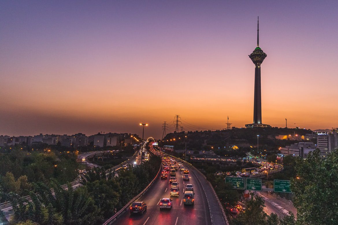
Due to the extent of Tehran, Having a vehicle for sightseeing in Tehran is essential. You can use buses, taxis, subways, online taxis, and even bicycles to travel in the city.
The current capacity of the streets due to the traffic of large numbers of cars, most of which are moving with one or two passengers, quickly completes and causes kilometers of traffic. As a result, people coming and going will inevitably have to endure wasted time and stress on the streets. As a result, using the metro, buses, and other public transportation is a better solution.
Tehran Metro System
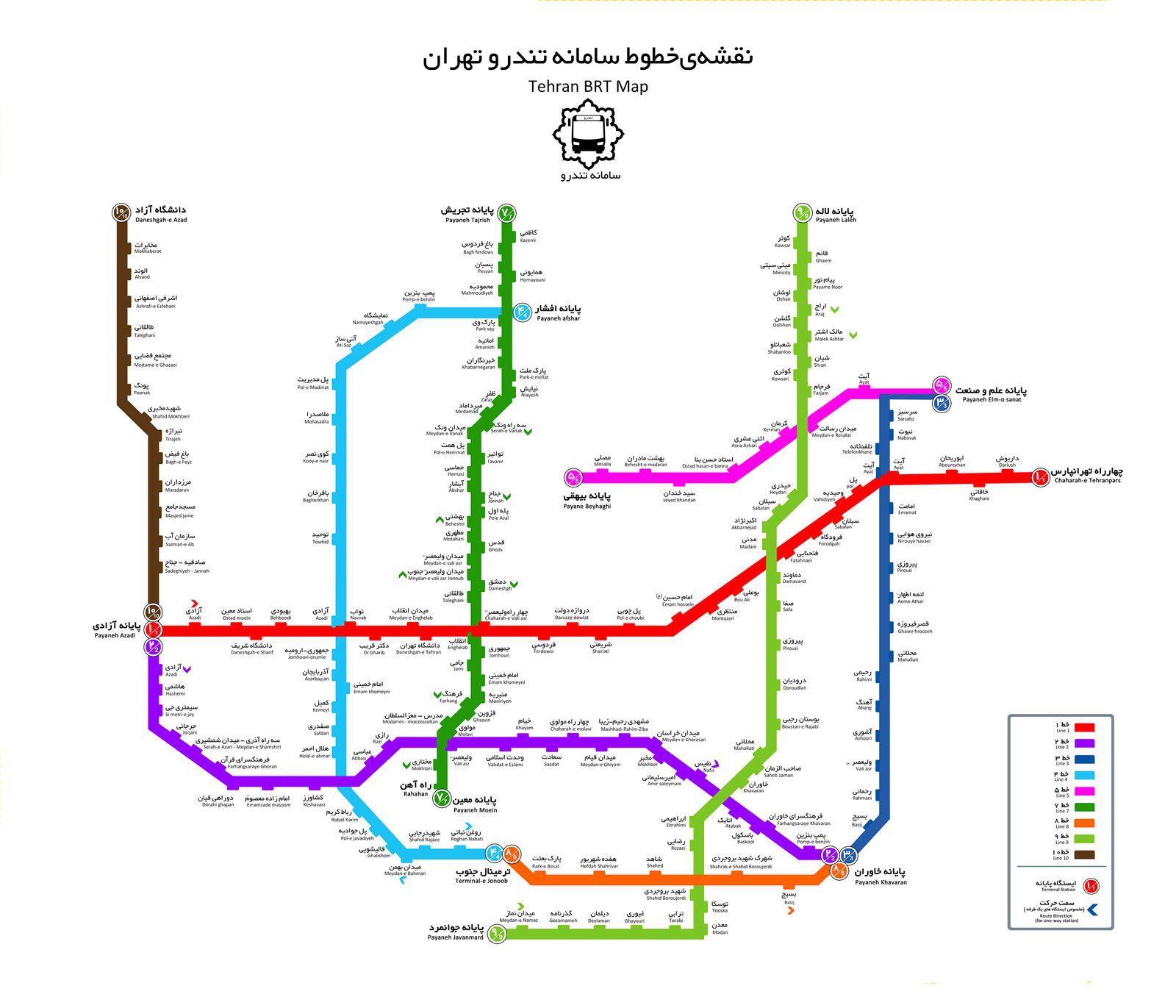
Metro is one of the best vehicles in Tehran. In Tehran, public transportation, such as subways and buses, is superior to other modes of transportation such as taxis. Tehran Metro system is one of the safest and fastest ways to travel. This program includes seven operational metro lines. Lines 2, 3, 4, 6, and 7 are entirely inner-city, and line five on the route from Tehran to Golshahr, Karaj, is intercity. Tehran Metro Line 1, with a branch near the End stations towards Imam Khomeini Airport, is in the primary part is within the city, and after this change of direction, it is intercity.
On all days of the week, metro services run approximately 05:30 to 23:00 GMT.
Regardless of the distance traveled, it costs much less to use prepaid tickets. In addition, seniors may travel on the subway for free.
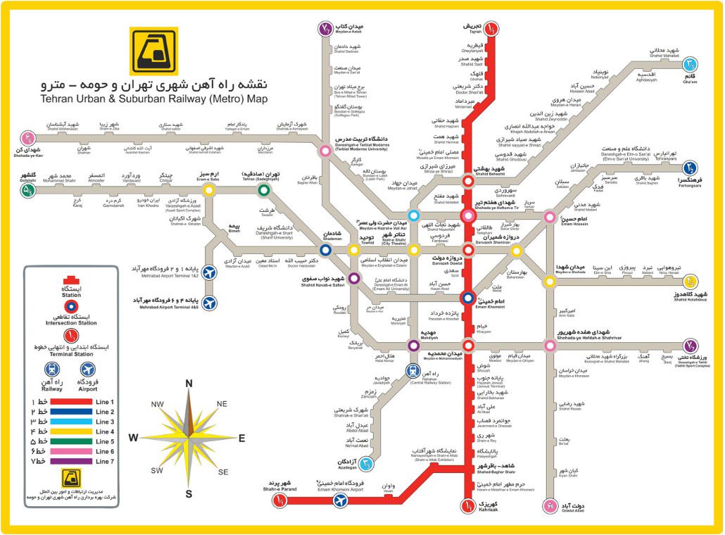
Line 1 of the Tehran Metro system is displayed in red on the map of the Tehran Metro system and connects the north of Tehran to the south. This line has 29 stations, and the route from Kahrizak to Tajrish is about 42 km long. The deepest metro station in Tehran is Tajrish station, dug and constructed with a depth of more than 40 meters in a Tehran metro line. Other features of this line include easy access for citizens from the southernmost point of Tehran to the northernmost points of the city in the lowest Possible time, passing essential areas and places such as the holy shrine of Imam Khomeini, Grand Bazaar, Imam Khomeini Square, Shohada-ye Haftom-e Tir, Mosalla Imam Khomeini, Mirdamad Boulevard, etc. Furthermore, easy access for passengers Domestically and externally pointed to the capital through the two stations of Terminal Jonoob and Shahed (intersection with the line of Imam Khomeini International Airport).
Tehran Metro Line 2 is the busiest in the capital, connecting the west and east of Tehran. This line currently has 22 stations, and its route from Sadeghieh to the new terminal area of East Tehran is about 32 km. One of the features of this line is the reduction of traffic load on the two busiest highways of the capital (Hemmat and Hakim) due to the connection of the west to the east of the city and the transfer of passengers Alborz province through Sadeghieh station. This line saves time, reduces pollution, and passes through essential areas such as Sadeghieh Station, Sharif University, Imam Khomeini Square, Baharestan Square, Imam Hossein Square, University of Science and Technology, etc. and Satisfaction of users.
On the map, Tehran Metro Line 3 is marked in pale blue and passes through 24 active stations on the northeast-south route. The route of this line is about 37 km from Azadegan highway to Azgol and Niavaran areas. Tehran Metro Line 3 has won the International Golden Clay Award for speed in completing the project and getting passengers. Other features of this line include the longest metro line in Iran, the existence of the only waiting hall at Valiasr station, which is one of the most beautiful stations in terms of architecture and execution, and variety in construction (using three mechanized methods, Austrian And open tranche) pointed out.
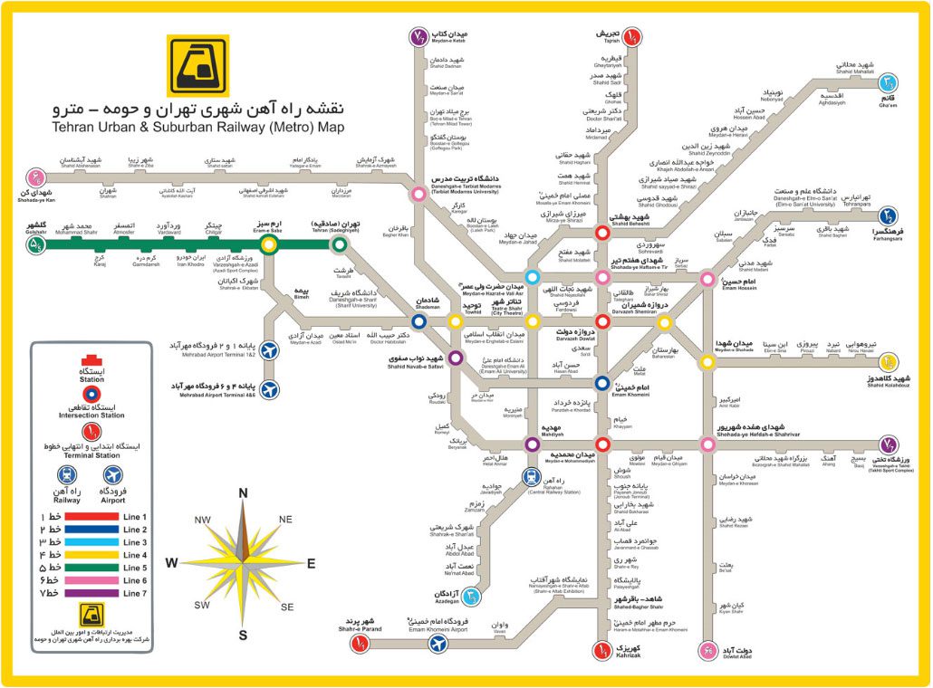
Tehran Metro Line 4 is marked in yellow on the metro map, and its direction is east-west. This line has 19 active stations, and its route is 22 km from Ekbatan station (Eram Sabz) to Shahid Kolahdooz station. One of the features of Line 4 is that it passes under busy streets such as Azadi Street and Enghelab Street. This line has provided valuable services to travelers by passing through essential areas and places such as Piroozi Street, Shahr Theater, Azadi Square (West Terminal), Ekbatan Town, and Azadi Stadium.
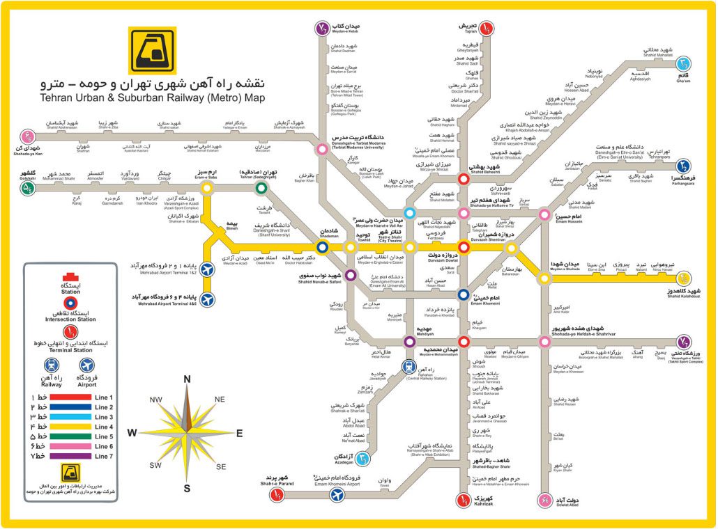
Tehran Metro Line 5 is marked with green color and has 11 active stations, and its route, from Sadeghiyeh to Golshahr, is about 43 kilometers long. Line 5 of the metro runs parallel to Tehran-Qazvin highway and is between the city and extends from Sadeghiyeh Square in western Tehran to Hashtgerd.
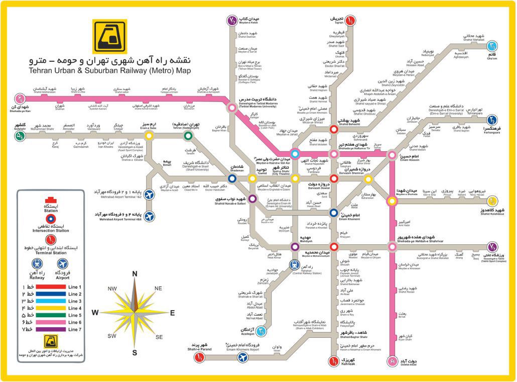
Tehran Metro Line 6 is on the pink map. This line has 27 active stations, and its route, from Dolatabad Highway to Shahrak-e-Kan, is about 31 km long. The features of this line include having the most intersection stations with other Tehran metro lines with seven intersection stations and covering the remaining two parts of Tehran in the northwest and southeast.
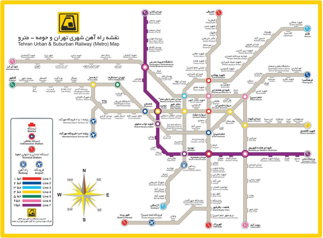
Tehran Metro Line 7, shown in purple on the map, has 11 active stations. The route of this line, from Takhti Stadium to Saadat Abad Park, is about 27 kilometers long, and from Navab Safavi to Mahdieh station, intersections (Navab Safavi = Line 2, Mahdieh = Line 3) are included.
To buy a metro ticket, you can purchase single-table tickets through kiosks at stations, or if you use subway cards, charge your card to the desired amount using card charging devices at all stations.
Tehran Airports
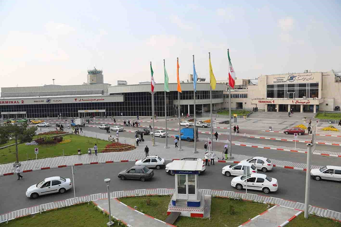
Mehrabad International Airport is Tehran’s first international airport. Currently, Mehrabad Airport, with four terminals, welcomes about 18 million passengers annually with the cooperation of 15 domestic airlines.
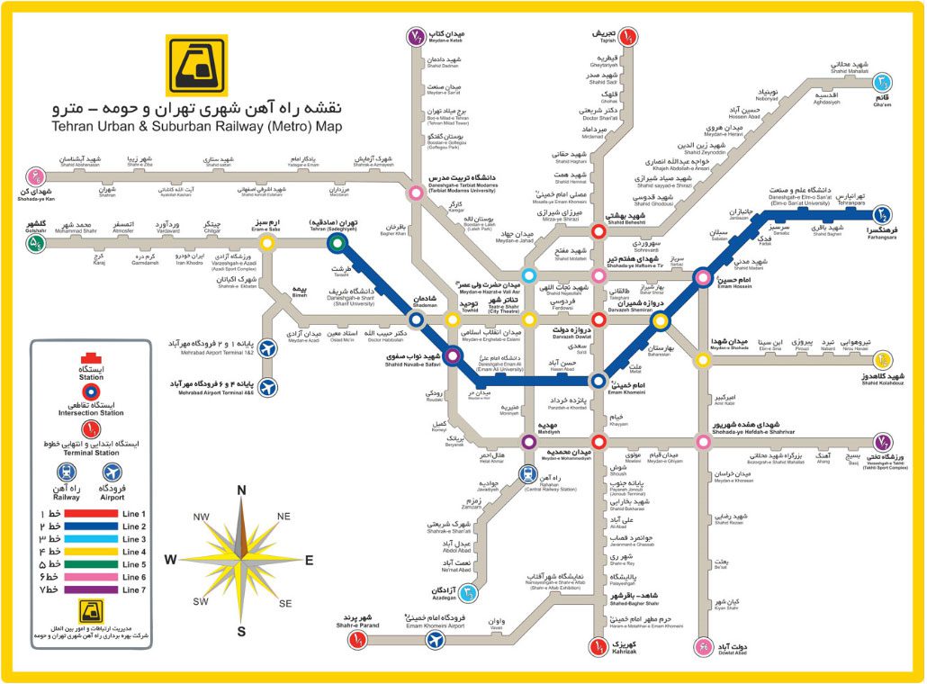
There is a clear indication for those who go to Mehrabad Airport for the first time and may not know the route well. The airport is almost facing the town of Ekbatan, which is one of the residential complexes west of Tehran due to the size and height of its modern buildings. The metro station through which to reach the airport is near the metro station of Ekbatan town. The Bimeh station on the Yellow Line, located between Ekbatan Town Station and Azadi Square, has a sub-route, which is also characterized by the yellow line. This sub-route will take you to Mehrabad Airport and has two exits. The doors of the Mehrabad airport terminal metro station have the specified names of Terminals 1 and 2 of Mehrabad Airport and Terminals 4 and 6 of Mehrabad Airport. As their name implies, they will lead you to two parts of terminals 1, 2, 4, and 6, thus allowing access to all internal terminals of the airport. Currently, the metro does not have a station at terminals 3 and 5 related to pilgrims’ trips.
The intersection of the yellow and red lines to reach Mehrabad Airport
The red north-south line, called Line 1, is a long line that starts from Tajrish station in northern Tehran and continues to Kahrizak station in the south. The location of the intersection of this line with the yellow line station is the Darvazeh Dowlat station, which if you have boarded the train from the north and the stations of Tajrish, Gheytarieh, Shahid Sadr, Qolhak, Dr. Shariati, Mirdamad, Shahid Haqqani, Shahid Hemmat, Mosalla Imam Khomeini, Shahid Beheshti, Shahid Mofah, Shohada-ye Haftom-e Tir and Taleghani, you can easily change your line at the Darvazeh Dowlat station and take the western route of the yellow line to reach the Bimeh station and enter the stations of Mehrabad airport from the sideline.
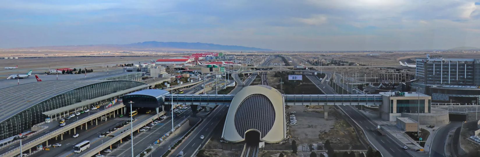
Imam Khomeini International Airport is located 30 kilometers from Tehran on the Qom-Tehran highway and in the Fashafouyeh section of Shahr-e-Rey. Therefore, Tehran metro system as public transportation can refer to Imam Khomeini airport city.
Imam Khomeini Airport City Metro Station is located in passenger terminal no. 1 and at the outlet level of this terminal. To use the metro to reach imam Khomeini airport city, at the end of line one of Tehran metro system and the station “Shahr-e-Aftab,” the line should be replaced, and the specific train of Imam Khomeini Airport City should be used.
The first train departs from Imam Khomeini Airport City at 6:50 am, and the last train departs from Shahed station to Imam Khomeini Airport City at 7:15 pm. Also, the commute interval of each train on the line of Imam Khomeini Airport City is 80 minutes.
Bus System
Tehran Bus system Is one of the oldest urban transportation organizations that has moved many citizens from the past to the present. From the past to the present, buses have made a massive contribution to the daily movement of people in Tehran, and now, after many years, it is still one of the leading public transportations. Tehran has many bus terminals that are generally divided into four terminals: The Jonoob Terminal (the largest bus terminal in the Middle East), east terminal, west terminal, and Argentina Square terminal (Beyhaghi) with almost all cities of Iran and some foreign countries have regular public transport and VIP.
Transportation status in zones 1, 2, and 3 of Greater Tehran
Traffic in District 1 of Tehran (Shemiranat)
District 1 of Tehran, in the northernmost point of Greater Tehran, is located on the southern slopes of the Alborz mountains and has ten districts and 27 neighborhoods. This area is restricted from the north to the heights of 1800 meters and Surrounding, from the east to Lashkarak Road and Quchak (Yas) Forest Park, to the west to the lands around the River of Darakeh, from the south to Shahid Chamran Highway (up to the crossroads of Azadi Hotel) and Modarres-Shahid Highway to The Nirooye Zamini Boulevard.
Shemiran Taxi Terminals
- Minicity: Artesh Boulevard, next to the fire station
- Eram: The northern side of Tajrish Square
- Mahallati: North Side of Minicity Crossroads
- Gheytarieh: Shariati Street, next to Gheytarieh metro station
- Nobonyad: The northern side of Nobonyad Square
Shemiran Bus Terminals
- Tajrish: Tajrish Bridge – opposite Imamzadeh Saleh
- Shahid Afshar: North East Side of Parkway
- Shahid Dastvareh: Farmanieh Dastvareh Street
- Laleh: Artesh Highway – End of Laleh Alley
Metro lines and stations in Shemiran
Line 1: Tajrish Station, Gheytarieh Station, Shahid Sadr Station
Line 3: Nobonyad Station, Shahid Mahallati Station, Ghaem Station
Also, the Aqdasiyeh station is under construction which will be operational this year.
Traffic in Tehran’s District 2
District 2 is located in the middle and north of Tehran. The area consists of 9 districts and 21 neighborhoods adjacent to districts 1, 3, 5, 6, 9, and 10. Its geographical location is enclosed from the north to Alborz heights, south to Azadi Street, east to Shahid Chamran Highway and Tohid Street, and west to Ayatollah Ashrafi Esfahani highway and Mohammad Ali Jinnah.
BRT Lines Area 2
Number of Stations: 7
Line: Line 4
Origin: South Terminal
Destination: Parkway Crosswalk
Bus Terminals of Zone 2
Sanat Square Terminal
Metro lines and stations in Zone 2
Line 2, Line 4, Line 6, and Metro Line 7
Traffic in District 3 of Tehran
District 3 is located in a region of Tehran with lands between Old Tehran and Shemiran and is currently located in the northeastern region of the city. District 3 borders district 1 in the north, district 4 to the east, District 2 to the west, and districts 6 and 7 in the south, and this region has 12 neighborhoods in the status quo. The geographical area of this region is from the north of Shahid Chamran Highway from Seoul junction to Vali-e-Asr Street, Shahid Modarres Highway to Sadr Intersection, Sadr Highway to Pasdaran Street intersection. From the east of Pasdaran Street, from the intersection of Shahid Modarres to the three-way of Zarrabkhaneh, Shariati Street is from Zarrabkhaneh to Resalat Highway. From the south of Resalat Highway, from the junction of Shariati Street to the junction of Shahid Modarres Highway, Shahid Modarres Highway to the intersection of Shahid Hemmat Highway, Shahid Hemmat Highway to the intersection of Shahid Chamran Highway, and finally, From the west of Shahid Chamran Highway is from the junction of Shahid Hemmat Highway to the junction of Seoul.
Metro lines and stations in Zone 3
Among the metro stations in this region are:
- Dr. Shariati metro station.
- Shahid Haqqani metro station.
- Shahid Hemmat metro station.
- Qolhak metro station.
- Mirdamad metro station.
Final Points
In addition to the transportation systems stated above, the use of taxi and bicycle systems is also every day in Tehran, accessible and used in different regions according to passengers’ needs. It should be noted that Tehran’s taxi fleet with more than 100,000 taxi drivers and about 80,000 taxis transports 4.5 million passengers daily, which accounts for 22% of urban transportation trips in 22 city areas, which is a significant figure according to the available facilities. Also, due to the high pollution index in Tehran and the strategies for managing this crisis, bicycles are one of the methods of daily transportation. Currently, 180,000 bike trips are made daily.
Finally, to make users more familiar with transportation systems in Tehran, the link to the map of active metro lines, suitable metro lines for people with disabilities and blind people, and active BRT bus lines are shared.
If you are planning to Tehran Apartment Rental or looking for Luxury Apartments in Tehran, talk to Tehran Offers Real Estate experts, one of the best and most comprehensive Tehran real estate. We wish you a good stay in Tehran.

Join The Discussion